The Lofoten Islands are an archipelago in northern Norway, above the Arctic Circle. There are 6 major islands that were formed from glaciers carving steep sided valleys between razor-like ridges and peaks. These vary from dramatic to extremely dramatic. Human habitation is largely defined by coastal fishing towns. Lofoten sits near the meeting of the Atlantic gulf stream and the colder Arctic Ocean, which leads to rich fishing grounds. Our plan was to head south through Norway and we’d start by navigating the Lofotens with a ferry back to the mainland at their southerly point.
The travel literature we read noted how popular the Loften islands are as a tourist destination. It’s true that you see more mobile homes and campervans on the island’s main (only) highway than cars. But the islands are a long way to get to which naturally limits the number of people. Despite it being peak season we didn’t feel like we were in any way crowded or part of a tourism machine.
Entering Norway
We drove west from Abisko in Sweden on the E10 to the Norway border. This is the mostly northerly Sweden-Norway highway crossing. As the road climbed, the terrain became rockier and the river, which road followed, more dramatic. After the border it was still rocky, but the shapes softer and there were many small residences dotting the hillsides. We also saw a WW2 memorial. In 1940 the pass was an important strategic point. Kiruna and Gällivare in Sweden have one of the world’s biggest iron ore mines and the Nazis wanted to secure control of that and the port in Narvik, Norway. Despite heroic resistance from Norwegian soldiers, they eventually did.
Once in Norway we continued west on the E10 toward the Lofoten Islands. We stopped twice, once for a bad coffee, and another time to feed Zeus, make a proper coffee and decide to continue driving to get to the Lofotens. This was a good choice, the scenery was amazing and we finished the day’s journey at a wild camping spot at a harbour in Fiskebøl, on the northern coast of Austvågøy, the northernmost of Lofoten’s Islands.
Austvågøy
Storholmen
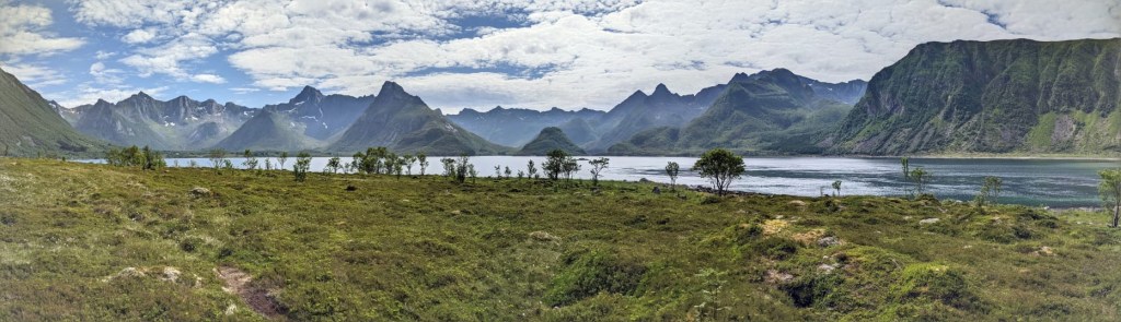
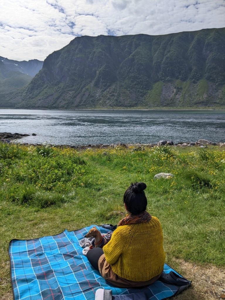
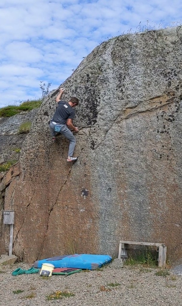
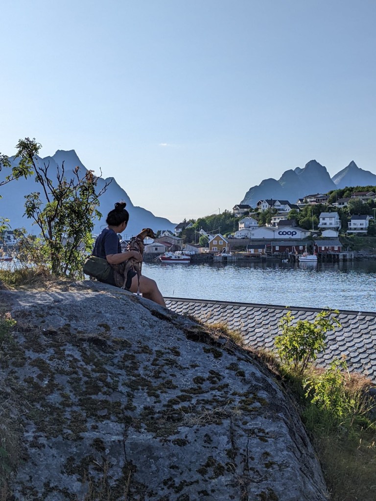
The following day we were quite tired from the previous day’s drive, so we took it easy. James did a bit of bouldering in the same spot we’d stayed overnight and we chatted with some other campervans, before we packed up and started heading south on some local roads. We hadn’t made it very far, when we spotted a quiet and beautiful spot for lunch, Storholmen.
Storholmen is a (very little) island in a bay, with bridges on either side. If you weren’t paying close attention, you might not even notice it as you drove by. It was marked on google as a “Tourist Attraction”, and the single parking space was free when we drove by so we snagged it.
We prepared our lunch, then packed it along with some chairs and blankets and headed to a grassy clearing for a picnic. The views were EPIC. All around were jaggedy peaks and mountains, the water surrounding the island was clear and blue, with reflections of the mountains, the sun was shining, there were no mosquitoes.
We decided to stay overnight. So we spent the rest of the afternoon resting. James tapped quietly away on his laptop writing our blog, sitting in a chair under a tree. Aileen and Zeus took a nap on the picnic blanket, until it got too hot and they retreated to the same tree. It was nice to have a relaxing afternoon surrounded by amazing natural beauty. It felt like living the vanlife dream of just finding a great place and deciding to stay without any drama or complication.
Climbing in the Lofoten Islands
The following day we headed west towards Henningsvær, the main touristic town on Austvågøy, and also a location for some seaside boulder crags. It was raining. Rain is not ideal climbing weather, so we abandoned any plans to climb. The road into Henningsvær was busy and we figured this would mean finding parking would be difficult so we skipped any plan to sightsee too. We headed to a nearby camperstop for our rest day.
The next day was a rainy one so it was a good thing all we had planned was to rest.
The weather on the Lofoten Islands is notoriously bad, wet, unpredictable (choose your adjective) given its location. So we felt very lucky when the sun appeared the next day. By that time James had hatched a better climbing plan.
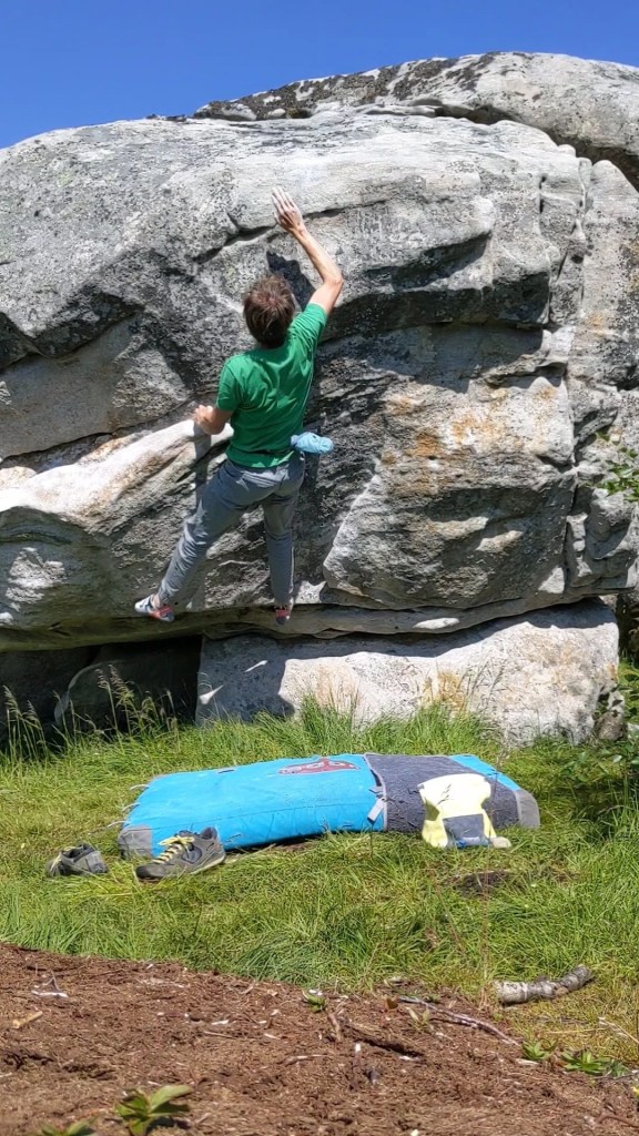
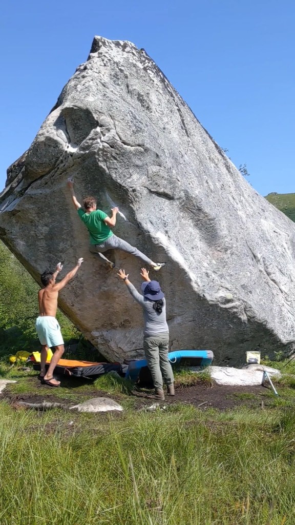
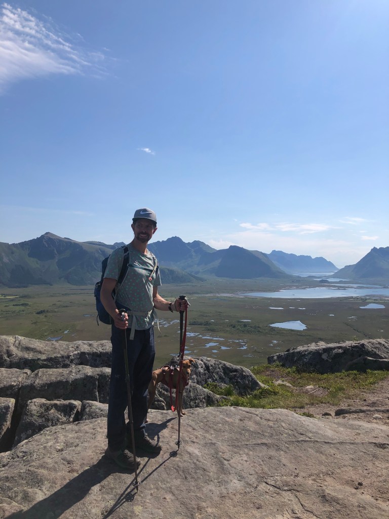
One of James’ friends sent him a very helpful YouTube video highlighting 5 of the best boulder problems in Lofoten. As luck would have it some were close to our campsite. So we had a productive day with visits to 3 crags. James did 2 of the problems in the video.
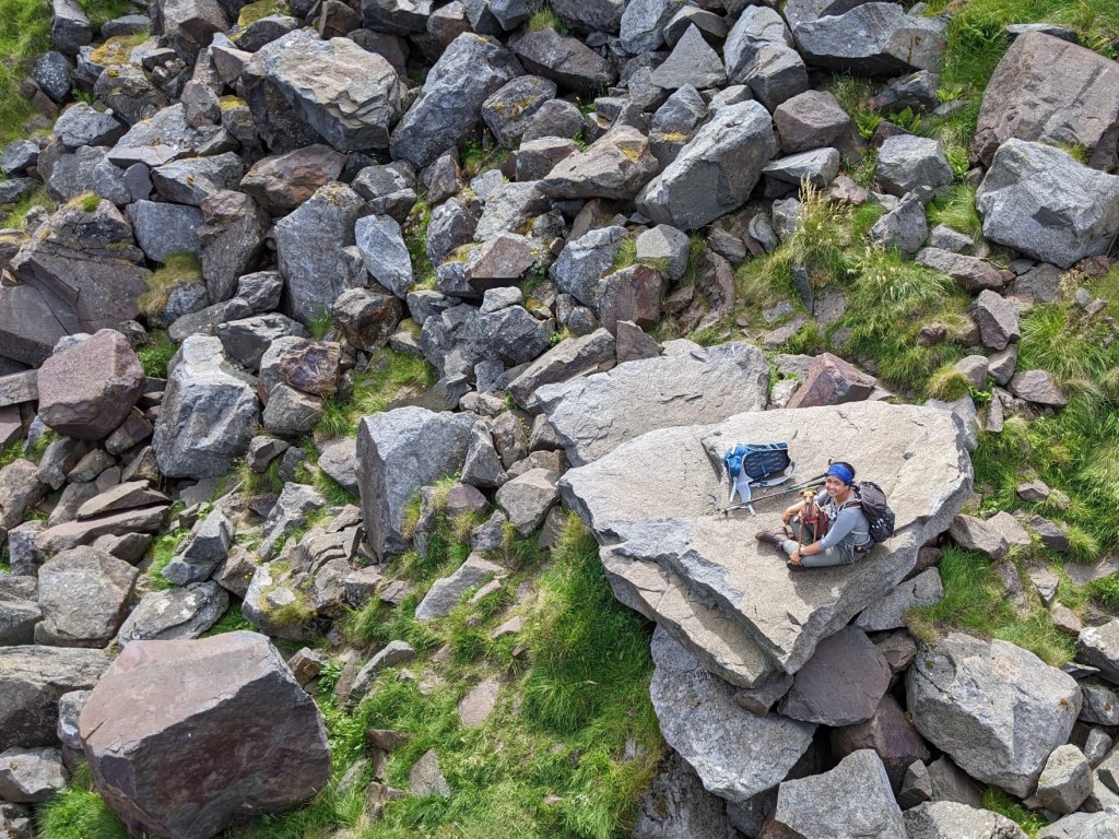
- King Fisher V6 at Trolldalstjønna. It is a steeply overhanging arete and has a very scenic backdrop. James was happy to flash. It is a nice climb, but ultimately he doesn’t think it will be memorable.
- Slartibartfast (great name) V8 at Skokkelvike was the problem from the video James really wanted to do. But it’s a harder climb and he was concerned you’d need a ladder to get off. Fortunately there was an ok downclimb and after a few attempts James climbed the line that starts on an arete, then moves on an 35 degree overhanging face and tops out at the apex of the boulder. For James it’s the hardest thing he’s climbed on rock since before his aneurysm and shoulder injury. That is something to be very happy about.
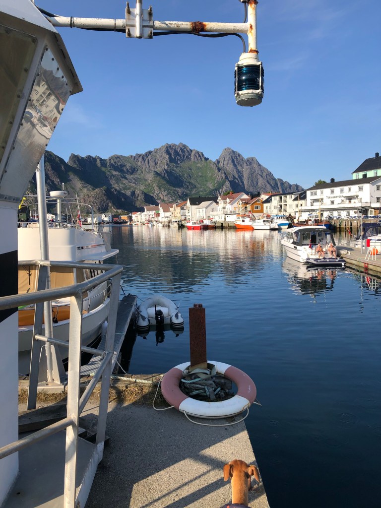
Henningsvær
It was late afternoon by the time our climbing objectives were met. We figured tourist-peak time would be over at Henningsvaer, so there we headed.
Henningsvær is a charming picturesque fishing town spread over 2 small rocky islands with a causeway in between. It’s called the “Venice of the Lofotens”. This is presumably because buildings line the edges of the islands and the sea sits in between. It was definitely pretty, but not quite Venice-like. It also wasn’t overly busy with tourists and parking was no issue (caveat: it was late Monday afternoon).
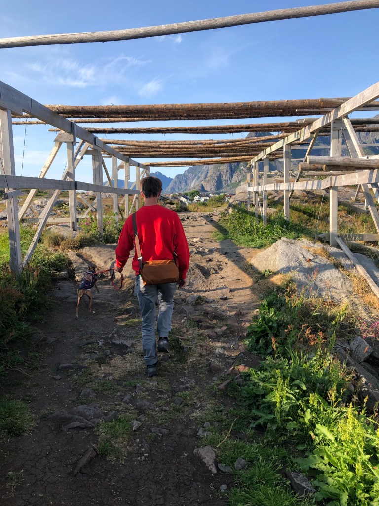
We had a waterside coffee at Klatrekaféen (“climbing cafe”), before meandering down the single main street which had small boutique shops – a yarn one, an artists studio or two, a small grocery, small cafes and restaurants. We crossed over the single causeway to the football pitch next to which is some high ground with views of the town and out to sea. It is remarkable to see a flat green rectangle (the football pitch) set in an otherwise rocky island, completely surrounded by sea and other rocky islands. The high ground is also where the town’s fish drying racks are. Unfortunately they held no fish. It turns out the drying season is December to April, when we could imagine it would be an incredible sight to see thousands of cod drying in the open freezing air.
Cod fishing is the main industry of the Lofotens, and much of its fresh and dried cod is exported to Europe. Stockfish is what the Lofotens are particularly famous for. This is cod, unsalted, and dried for months in the open in the winter. The freezing air temperatures keep the fish from spoiling, so salt isn’t required. Another interesting fact is that much of the heads of dried cod are exported to Nigeria for use in traditional Nigerian dishes!?
We enjoyed our visit to Henningsvaer. The influence of tourism is evident, but hasn’t destroyed the essence of the place.

Gimsøy
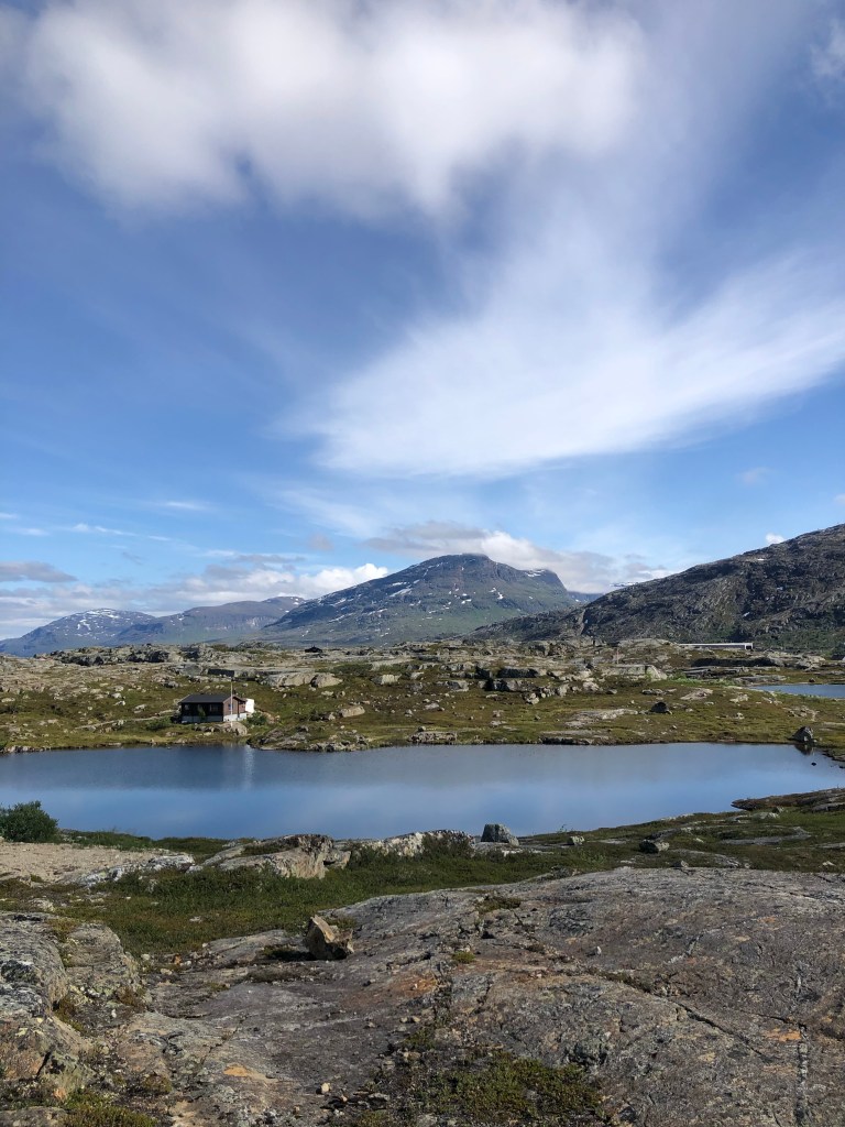
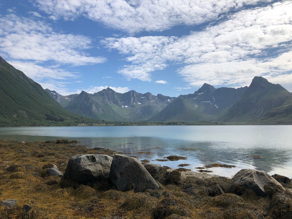
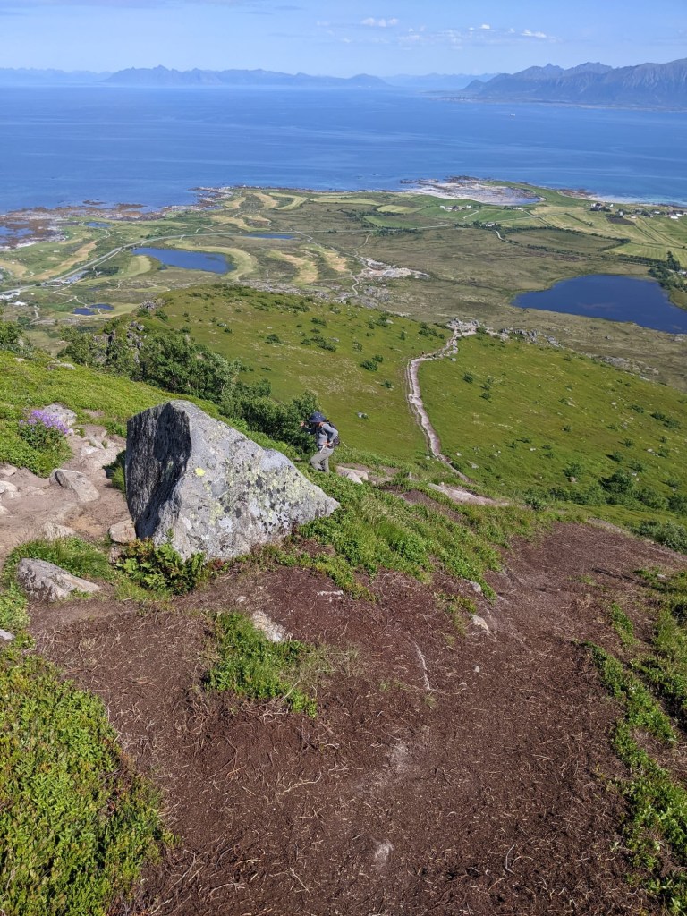
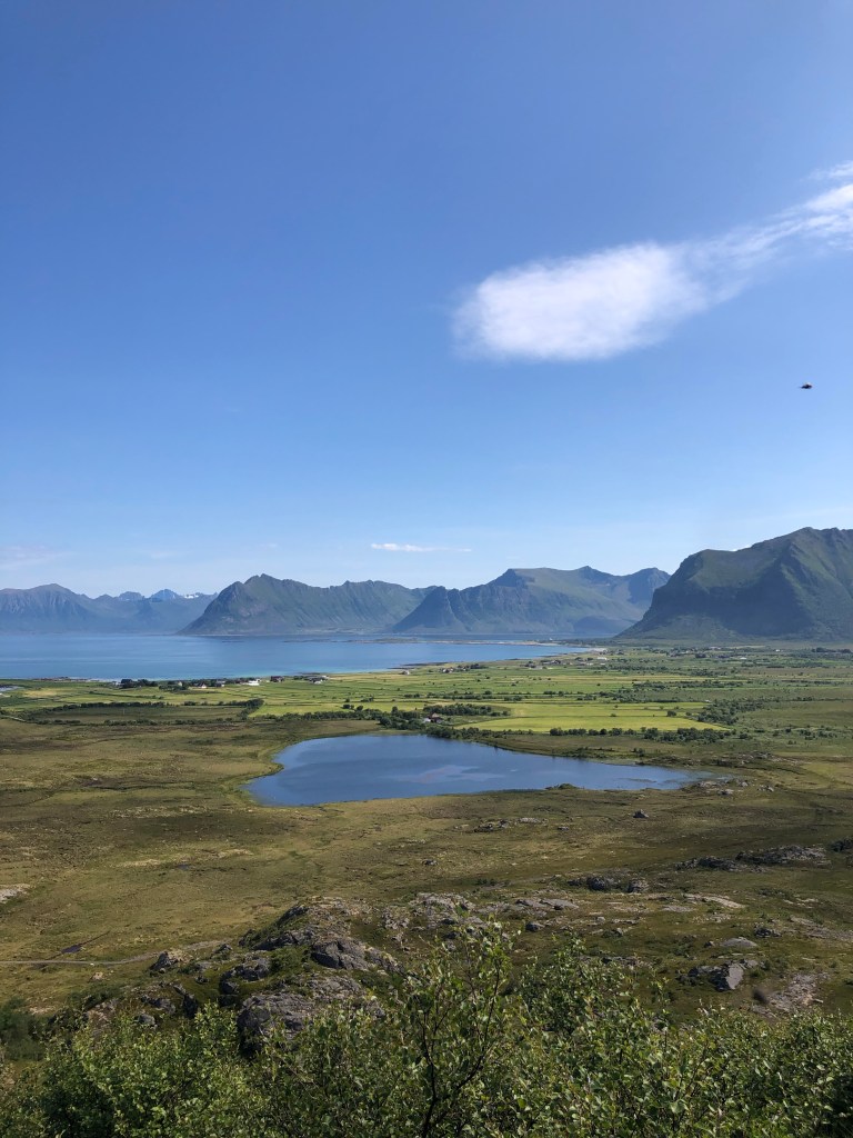
The following day we headed to the next main island, Gimsøy. We headed to Hoven, a small mountain on the northern end of the island. Hoven sits on its own which is unusual for Lofoten where most of its mountains are parts of chains, forming U-shaped valleys gauged by glaciers.
The steep climb up was made torturous by the swarms of flies. But the views at the top were more than rewarding. Hoven is surrounded by the sea on one side, and flat marshy (fly-ridden!) land flanked by mountain peaks on the other. We felt higher up than the 358m height of Hoven. The mountains in the Lofotens aren’t actually that high – the highest is Møysalen at 1,262m. What makes them particularly striking though is how steep they are, rising up to very pointy peaks and ridges, and also how densely they sit on the relatively small Lofoten Islands.This makes the islands look otherworldly, or just plain magical.
Note: The steepness of Lofoten mountains means that many hikes require either scrambling up steep slopes, or technical equipment. This wouldn’t be practical or safe with Zeus (or Aileen for that matter), so we skipped these. Sorry, afraid we can’t report back on hiking the Devil’s Gate!
Vestvågøy
From Hoven we headed further south to Vestvågøy, another main island. We’d actually visited before, as the crags we visited were on the island, across the water from our campsite. The Lofoten Islands are separated by narrow channels so on many occasions we didn’t even notice we were on another island.
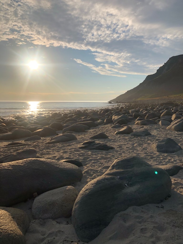
We headed to Unstad, a small beach town situated at the base of a U shaped valley looking out to sea. We’d chatted with a Norwegian lady in a parking lot in Sundsvall, Sweden and she’d given us a list of her favourite places in the Lofotens. Unstad was one of them. I doubt we would have found it without her recommendation. It was surreal. The beach was wide and sweeping. And on the beach and in the sea were dozens of surfers! We camped in a parking area by the beach and enjoyed a sunset stroll.
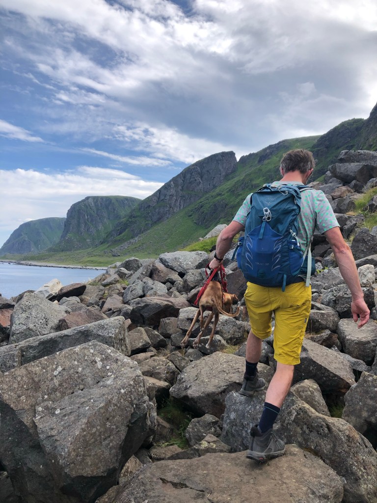
The following day we decided to do a relaxing hike along the coast directly from the parking. It turned out not to be so relaxing. We’d forgotten for a moment that mountains are steep in the Lofotens, so the coastal walk went up and down some steep paths and over slippery boulder fields. The views were amazing though, particularly looking back at tiny Unstad nestled in a valley surrounded by soaring peaks.

Flakstadøy
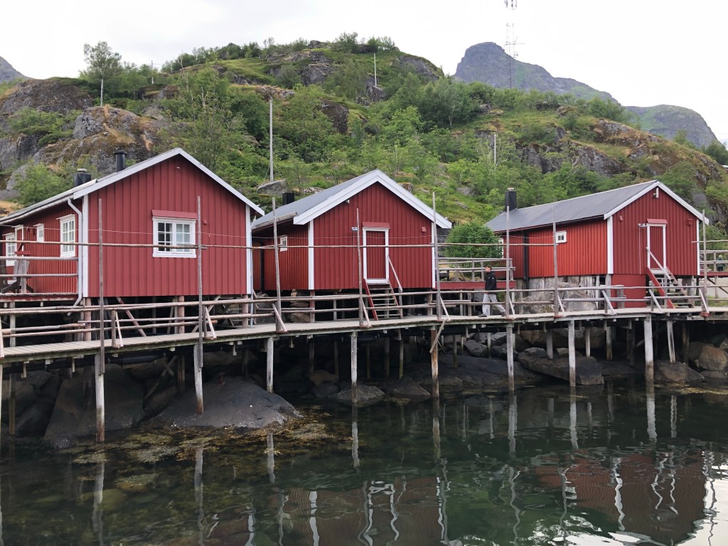
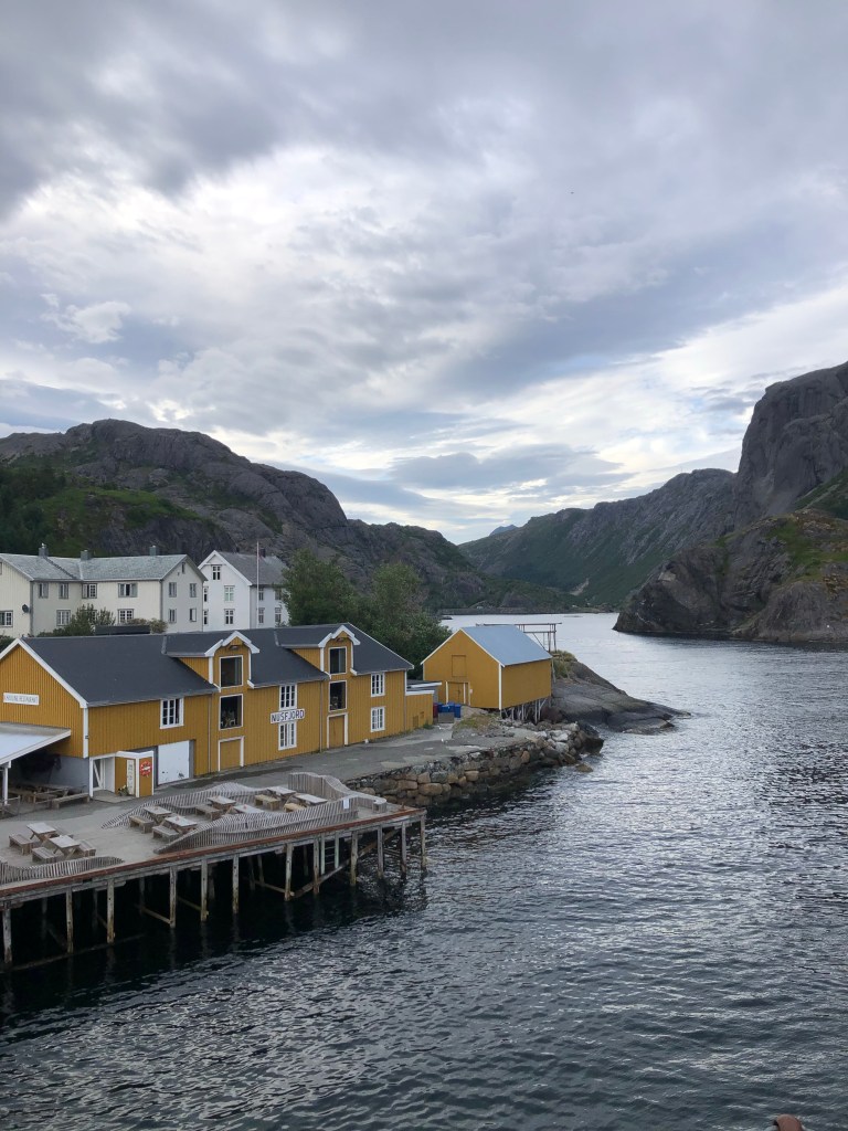
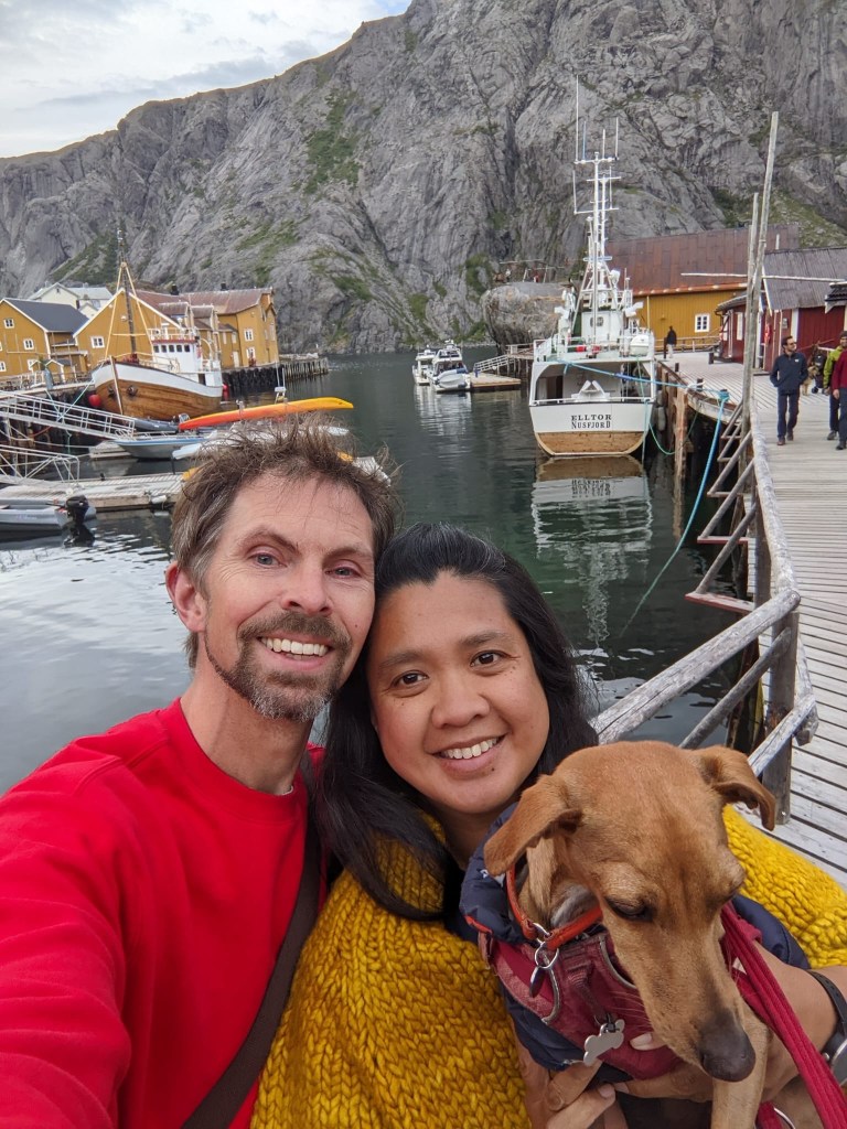
The next day we headed to Nusfjord on Flakstadøy, the next main island. The drive was beautiful as we passed rugged peaks through a narrow valley, onto the banks of a Nusfjord, a narrow fjord. The village of Nusfjord is (was?) a fishing village. It appears now to be mostly a hotel (aka arctic resort) so the old fishing buildings are well preserved, but it has the feel of a theme park. We walked along the pier, past some traditional robur (houses on stilts over water) to a viewpoint and lighthouse at the entrance of the fjord. We enjoyed some cheeky glasses of wine at a restaurant before doing the 5-minute walk back to our campervan, which was sat in a roadside parking area just outside of the village.
From Nusfjord we continued our journey south. With a brief stop for James to check out a climbing crag located in a marsh. After consideration he thought (correctly) this was not going to be somewhere Aileen and Zeus would enjoy spending the morning. We continued our drive and crossed onto our last island in the Lofotens, Moskenesøya.
Moskenesøya
Of the Loftoen islands Moskenesøya is the one which looks most like swiss cheese. With many lakes and fjord inlets it seems to have more of its area defined by water than land.
Our first stop was Reine, we stayed 2 nights in Reine with the intention of catching a ferry across its huge fjord inlet to Vinstad, in order to do a walk in Lofotodden Nasjonalpark which sits on the opposite side of the island.
Reine, we found, is a popular stop for tourists and has a choice of 2 campervan spots. We were pleased we chose the 240 NOK per night one, which is next to and no different from the 500 NOK per night one. We had a stroll around the town, enjoyed a drink in the evening sunshine and got some advice from the tourist office to get in the line for the ferry promptly in the morning.
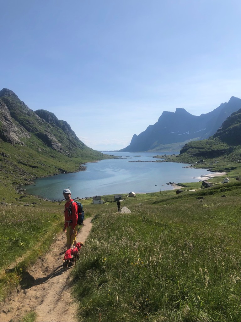
The next morning we made it to the ferry queue, 50 metres from our campervan, in good time. The boat ride to the start of the walk was spectacular, but a little rainy. Zeus, who hates the rain, needed some sheltering. After disembarking it was apparent that nearly everyone on the ferry had come to do the same walk so it was a bit of a procession past the few dwellings of Vindstad, which is only accessible by boat.
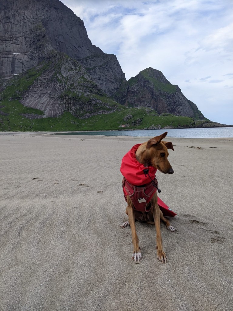
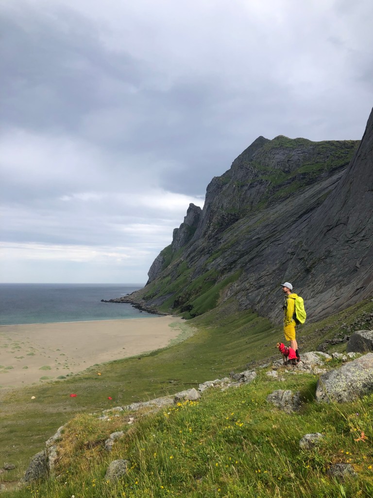
The walk was an out and back over a pass to a big natural bay and uninhabited Bunes Beach in Lofotodden Nasjonalpark. The beach is straddled by the pass and vertically rising mountain peaks on either side, and has grass topped sea dunes leading to the sea. It is certainly an instagram-photo worthy spot and feels remote and isolated. There were a number of tents dotting the beach – we can imagine it’s a great place for stargazing, and in the winter catching the aurora borealis.
By the time we reached the pass everyone had spread out. We got to enjoy the beach and let Zeus have a maniacal run about. We then retraced our steps to catch the ferry back in time (they are very clear on there being no option for overnight accommodation except camping if you miss it). The weather was much kinder on the ride back so we were able to enjoy the views of mountain sides towering above us and other branches of water leading into the main fjord.
From Reine we headed to Moskenes, our last stop in the Lofotens, and where we planned to catch a ferry back to the mainland. We stayed at a campsite next to the ferry port with views over the sea, helpful since we had a start of day sailing for Bodø on the mainland.
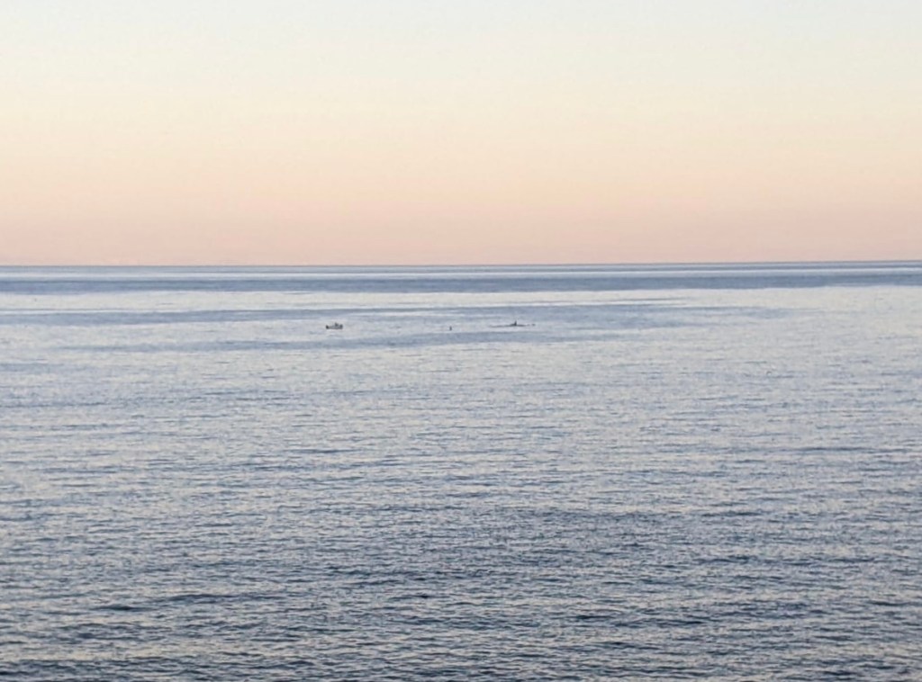
The best thing about the campsite is that we spotted orca’s there! Aileen spotted the dorsal fins of several whales first while sitting in the campervan, then worried momentarily that James, who had gone to wash dishes, would not see them. Thankfully he returned to the van, and we ran to and climbed up a big rock for a better vantage point. We saw different sized fins, plumes of water, and their tails as they slowly made their way past the campsite. Our conclusion from the number, behaviour and some internet research was these were orca’s herding their prey. To the naked eye it was all incredibly clear and exciting, we have some very blurry photos (that could be anything) to confirm 😉
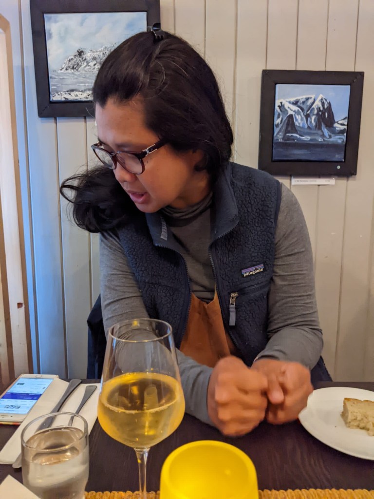
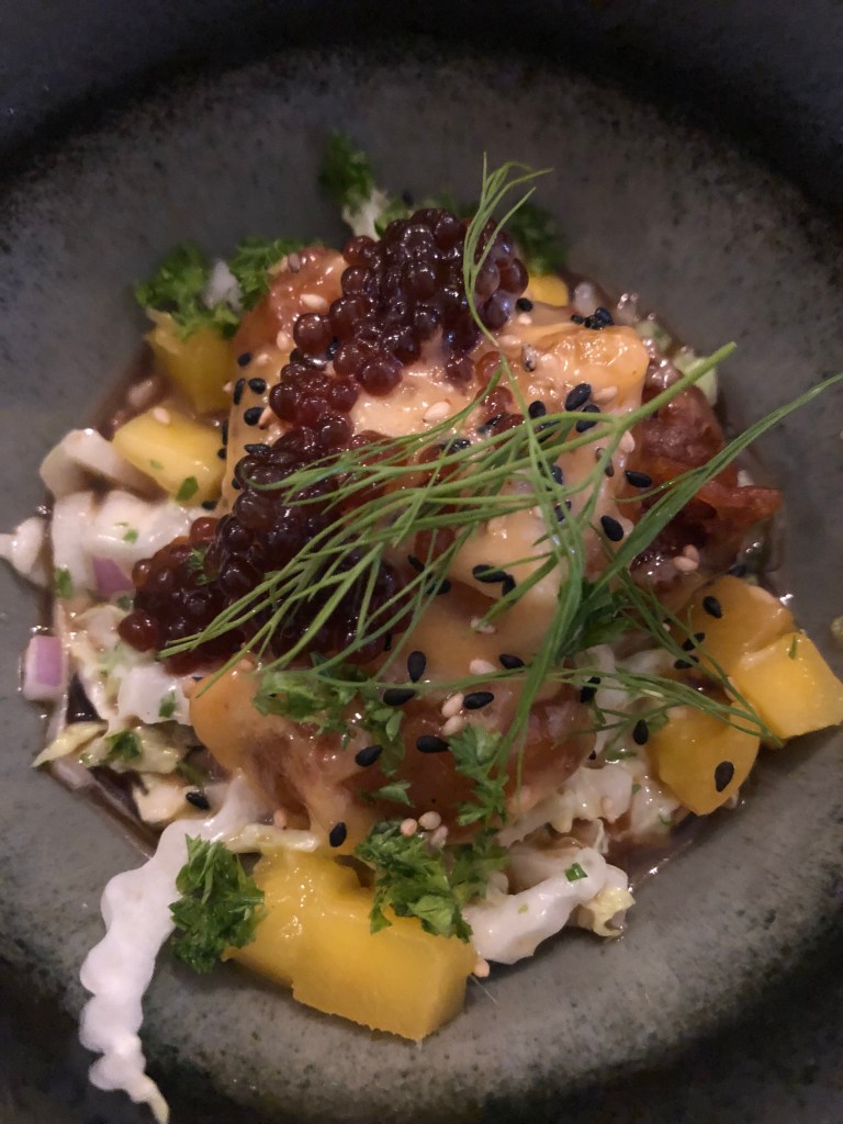
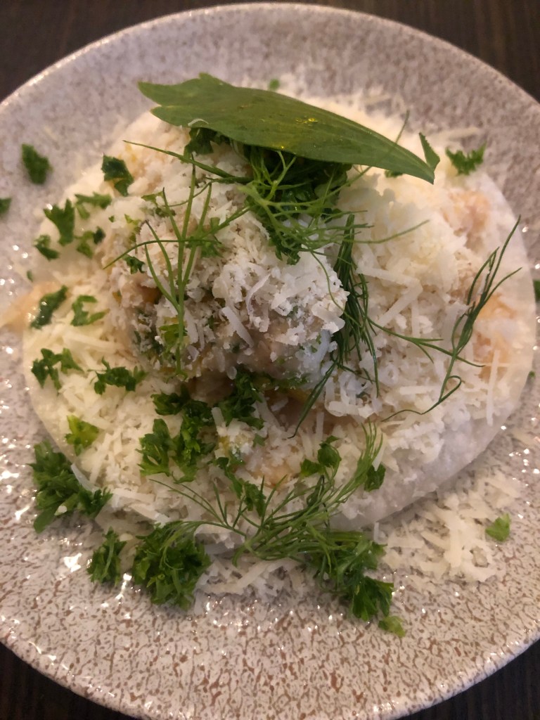
On our last evening in the Lofotens we had a nice meal at Maren Anna , a restaurant in neighbouring town Sørvagen. It was our first meal at a Norwegian restaurant. We did their tasting menu – all of the food was tasty and we particularly enjoyed the main course of stock fish. It was expensive though. We found food very expensive in Norway, both groceries and restaurant meals.
After dinner we took the quick drive to Å, a town which has a striking name – one we saw regularly on our journey through the Lofotens as it’s the southern end of the E10, the main and only highway of the Lofotens.
The following day waved goodbye to the Lofoten Islands from the ferry to Bodø, sad to be leaving the beautiful and magical islands, but also excited at the prospect of exploring more of Norway.

Leave a comment